The following products are no longer mass-produced, but in most cases spare parts and application support are available.
Skywatch® BL 1000
Wind speed and direction
| Measurement units | km/h, mph, m/s, fps, knots and Beaufort |
| Resolution | to the tenth decimal place |
| Precision | ± 3% / ± 0.5 km/h |
| Measurement range | from 3 to 150 km/h |
| Wind direction | accuracy ± 3°. |
Temperature measurement
| Measurement units | °C and °F |
| Resolution | to the tenth decimal place |
| Precision | ± 0.3°C |
| Measurement range | from -25 ° C to + 60 ° C |
Humidity levels
| Measurement units | %rH |
| Resolution | to the tenth decimal place |
| Precision | ± 3% (10-90 %rH) |
| Measurement range | from 0 to 100% HR |
Barometric pressure
| Measurement units | hPa, mbar and inHg |
| Resolution | to the tenth decimal place |
| Precision | ± 0.2 hPa |
| Measurement range | from 300 to 1'200 hPa |
May be incompatible with newer models
Skywatch® BL 300 BL400
Wind measurement (BL 300, 400 models)
| Measurement units | km/h, mph, m/s, fps, knots and Beaufort |
| Resolution | to the tenth |
| Precision | ± 3% / ± 0.5 km/h |
| Measurement range | from 3 to 150 km/h |
Temperature measurement (BL 300, 400 models)
| Measurement units | °C and °F |
| Resolution | to the tenth of a degree |
| Precision | ± 0.3°C |
| Measurement range | from -25°C to +60°C |
Humidity measurement (BL 300, 400 models)
| Measurement units | %rH |
| Resolution | to the tenth |
| Precision | ± 3% (10-90 %rH) |
| Measurement range | from 0 to 100 %rH |
Pressure measurement (BL 400 models)
| Measurement units | hPa, mbar and inHg |
| Resolution | to the tenth |
| Precision | ± 0.2 hPa |
| Measurement range | from 300 to 1'200 hPa |
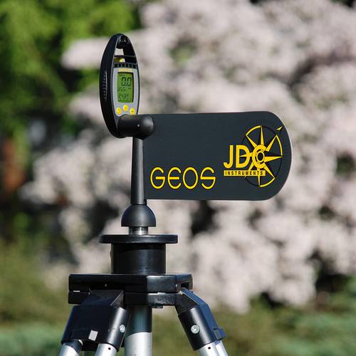
Skywatch® Geos 11 - Technical data
Wind measurement
| Measurement units | km/h, mph, m/s, fps, knots and Beaufort |
| Resolution | to the tenth up to 99.9, then to the unit |
| Measurement cycle | Snapshot |
| Precision | ± 2% FS |
| Measurement range | from 3 to 300 (peak) km/h |
Temperature measurement
| Measurement units | °C and °F |
| Resolution | to the tenth of a degree |
| Measurement cycle | very responsive |
| Precision | ± 0.5°C at 25°C |
| Measurement range | from -40°C to +85°C |
Humidity measurement
| Measurement units | %rH |
| Resolution | 0.1 %rH |
| Measurement cycle | very responsive |
| Precision | ± 2% to 50 %rH |
| Measurement range | from 0.1 to 100 %rH |
| Modes | Instantaneous, minimum, average, maximum and dew point |
Measuring altitude
| Measurement units | m and ft |
| Resolution | 0.1 m from -999.9 to 3'000 m |
| Precision | 0.5 m from 3'000 to 10'000 m |
| Measurement range | 1 m from 10,000 to 21,535 m |
| 0.1 m - 1m -1'000 to 21'535 m |
Absolute and relative pressure measurement
| Measurement units | hPa and inHg |
| Precision | ± 0.5% at 25°C, ± 1.5 hpa at 25°C |
Support for Geos
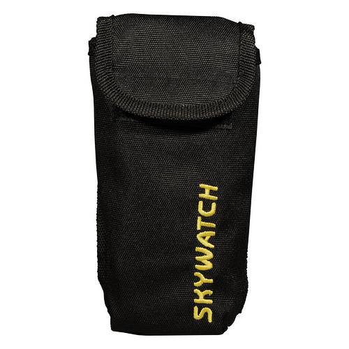
Geos 11 pouch

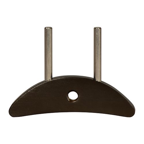
Weathervane for Geos 11
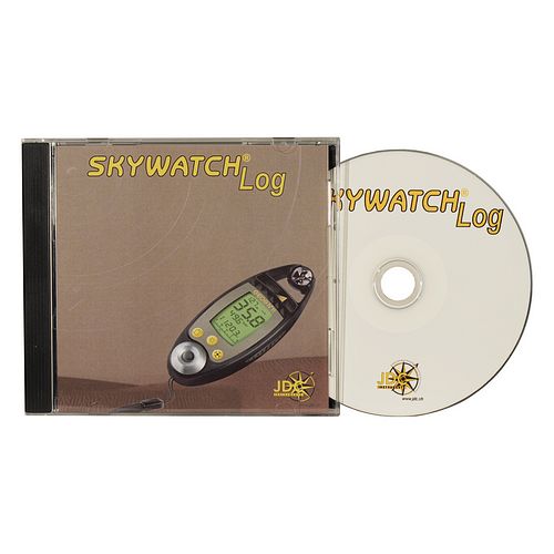
SkywatchLog software
Skywatch® Xplorer 1-4
Wind measurement (models 1, 2, 3, 4)
| Measurement units | km/h, mph, m/s, fps, knots and bft |
| Resolution | to the tenth decimal place up to 99.9, then to the unit |
| Precision | ± 3% FS |
| Measurement range | from 3 to 150 km/h |
Temperature measurement (Models 2, 3, 4)
| Measurement units | °C and °F |
| Resolution | to a tenth of a degree |
| Measurement cycle | one measurement every 0.5 seconds |
| Precision | ± 0.3 °C at 20 °C / ± 0.5 °C from -20 to +50 °C |
| Measurement range | from -30°C to +60°C |
Compass (models 3, 4)
| Measurement units | degree |
| Resolution | 1 degree |
| Precision | ± 4 degrees |
| Measure | in vertical position |
Altitude (model 4)
| Measurement units | m and ft |
| Resolution | 1 m / 3 ft |
| Precision | ± 10 m |
| Measurement range | from -700 m to +9'000 m |
Absolute and relative pressure (model 4)
| Measurement units | hPa and inHg |
| Precision | ± 1 hPa |
Xplorer pouch
Agros, AWS, Porosimètre MK1, SalinoMADD, Speedwatch, Windoo, News, Aero
This device measures the temperature and humidity of the air contained in forage bales, straw, windrows and so on, but can also be used in air, vegetation and granular materials (cereals). It measures the moisture content of the air between the cereals, rather than the cereals themselves. The instrument is fitted with an extremely resistant stainless steel probe, with an ergonomic plastic handle and a stainless steel tip. Not suitable for use in liquids.
The Skywatch® AWS measures, displays and warns the user visually and acoustically of temperature, humidity and wind speed. Minimum and maximum temperature and humidity values can be set individually. Wind speed can be measured on 2 levels. The display unit, which is independent of the sensors, offers a wide range of applications.

This porosimeter was developed and manufactured by JDC Electronic SA in response to very strong demand from paraglider manufacturers, mainly for safety reasons. This instrument quickly became the leader in the field of porosity. It is now used and appreciated all over the world.

The SalinoMADD is designed for hydrology professionals who often carry out flow measurements, sometimes in difficult conditions. It can record up to 15 measurement sites with a wide range of additional information.

This instrument gives you precise instantaneous speed on the water, maximum speed and distance covered on the water. All without having to make any modifications to your boat. Easy to install: fix the propeller underwater with one of the three fins supplied; place the radio transmitter in the hull. Magnetic transmission through the hull without holes (JDC patent) and radio transmission on the screen (up to four metres). You can mount the screen anywhere on the boat, allowing data to be transmitted to anyone with a receiver. You can use existing detection palettes. Possibility of calibrating interaction with any type of speed controller (JDC propeller or paddle sensor).


Skywatch® Windoo products are weather stations for your smartphone. They measure and transmit the following types of data: wind speed, temperature, perceived temperature, humidity, dew point and pressure.


Skywatch Aero- Flyer Commercial leaflet
Skywatch Aero - Owner's instructions
Skywatch AEROlog software
The SKYWATCH AEROlog software allows complete control of the station, including reading and exporting data, programming measurement intervals and selecting display units. Real-time measurements and recorded data can be displayed graphically.